Planar survey simulation · USGS-derived scalar fields
Adaptive survey
Development selection and held-out terrain
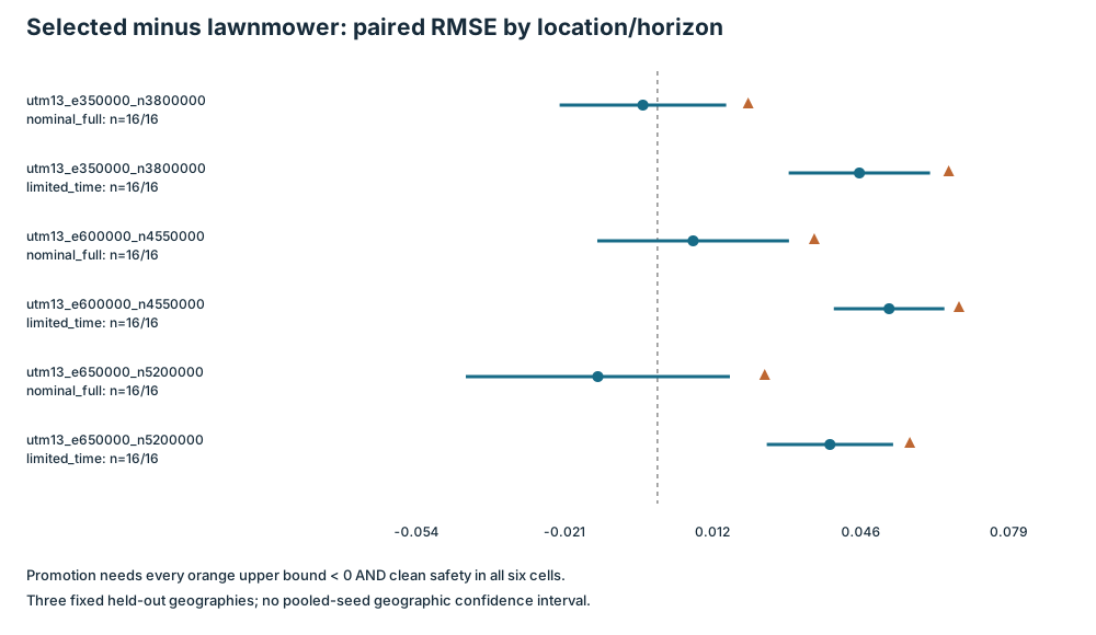
Baseline retained. The selected policy failed all six lawnmower RMSE promotion bounds.
- Simulation executions
- 516
- 36 development + 480 held-out
- RMSE promotion gates passed
- 0 / 6
- Selected policy versus lawnmower
- Unsafe executions
- 33
- Study-wide, across all evaluated policies
- Terrain split
- 3 / 3 / 3
- Train / validation / test locations
Recorded evidence
Results
36 development executions and 480 held-out executions on nine terrain fields.
Case 4 of 24utm13_e350000_n3800000 · nominal_full · lawnmower
| Metric | Selected guarded_early | lawnmower |
|---|---|---|
| Normalized map RMSE | 0.113533 | 0.116816 |
| Synthetic DEM-sensing RMSE m | 0.464608 | 0.478044 |
| Observed area fraction | 0.991577 | 0.989685 |
| Squared-speed energy proxy | 20.4647 | 18.8493 |
| Uncertified steps (total) | 0 | 0 |
| Unsafe episodes | 0 | 0 |
| Statistic | Value |
|---|---|
| Selected minus comparator RMSE | -0.00328332 |
| 95% interval lower | -0.0220418 |
| 95% interval upper | 0.0154751 |
| Paired seeds | 16 |
| Missing pairs | 0 |
| Promotion one-sided upper bound | 0.0204237 |
| Promotion one-sided alpha | 0.00833333 |
| Safety gate | True |
| RMSE gate | False |
Case notes & acceptance
Promotion comparison.
null = missing or not applicable, never zero. Intervals and sample sizes are reported in each table. Scroll tables horizontally to see every column.
USGS 3DEP / Field navigator
Terrain atlas
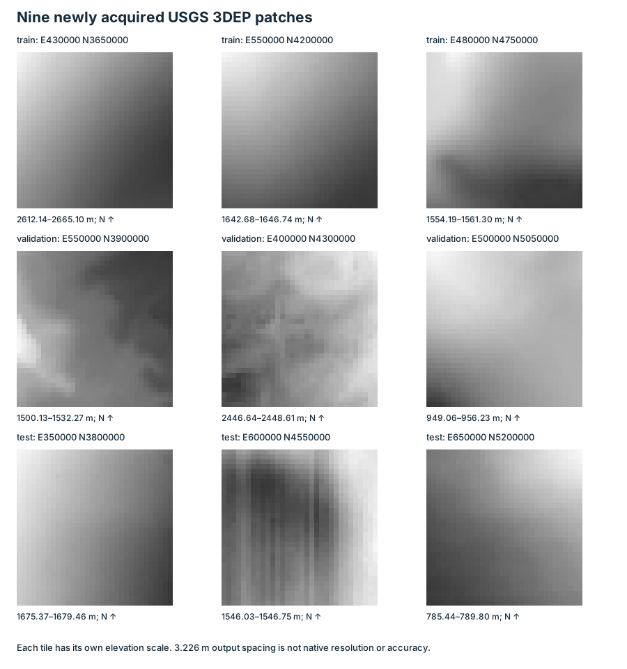
Actual elevation rasters used by the study. North-up, with colour scaled within each patch.
- Patch minimum
- 1,675.37 m
- Relief
- 4.09 m
- Mean above minimum
- 2.04 m
Raster processing & units
Elevation = offset + normalized value × scale. Colours show the actual raster; contours use linear interpolation on a fixed triangulation at 12.5% intervals of the normalized range. Sample centers span 100 m, with spacing 100/31 m. This is output sampling, not native resolution or accuracy. Per-patch colour scaling makes shapes comparable, not physical relief.
The navigator shows elevation, not rendered flight terrain or obstacles. Frozen train / validation / test assignments are in the original terrain figure below and the acquisition manifest.
Dataset methods →Report figures
Methods & interpretation
The development-only choice guarded_early fails all six lawnmower RMSE promotion bounds; limited-time mean RMSE is worse at all three test locations. Nine fresh USGS patches are split 3 train / 3 validation / 3 test, not a nationwide geography sample. Infrastructure hardening did not rerun episodes. Paired Student-t intervals are descriptive within each location/horizon; only lawnmower uses the six-cell Bonferroni promotion rule. Adaptive Lloyd bandit uses oracle evaluation reward. Per-patch normalization is not terrain sampling accuracy; DEMs are not obstacle or ecological maps.